Trek Highlights
- 15-day private trek through Lower Dolpo, including 3 nights at Phoksundo Lake (3,612m), the deepest lake in Nepal with turquoise water visible from the Ringmo village hillside.
- Dolpo culture: pre-Buddhist Bon religion, Tibetan-influenced architecture, blue sheep herds on the hillsides. Closed to outsiders until 1989. Still rarely visited.
- Restricted area permit required (USD 500 per person per 10-day period). We handle the paperwork. Licensed guide required, no minimum group size since 22 March 2026.
- Private guide and porter ratio that does not change based on group size. No shared-group surcharge gimmicks.
- 10% deposit to lock dates, balance paid in person in Kathmandu. No full prepayment required to a foreign trekker you have never met.
- Every booking helps fund our Nagarjun Learning Center work at Saldum, where 70 children are taught by one dedicated teacher.
Why I built this trek the way I did
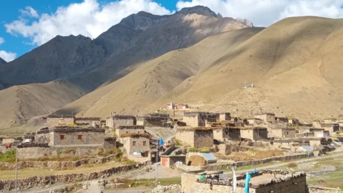
I am Shreejan, the founder of The Everest Holiday. Lower Dolpo is the part of Nepal that feels least like the rest of the country. The region was completely closed to outsiders until 1989, and even now the small-aircraft flight to Juphal is the only practical way in. There are no roads. The trails have not changed since the time of the Bon religion, which predates Buddhism in this region by a thousand years.
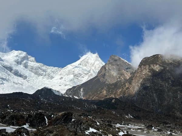
The 15-day route centres on Phoksundo Lake at 3,612m, which is the deepest lake in Nepal. The Ringmo village hillside above the lake is the photograph people come for: turquoise water below, the Ringmo houses with their flat earthen roofs, and the Kanjirowa range rising behind. We stay 3 nights at Phoksundo so you have time to walk the lake circuit and the side trail to the Buddhist monasteries above the village.
The Bon culture in Lower Dolpo is the reason serious cultural trekkers come here. Bon predates Buddhism in the Himalayan region by a thousand years, and the Bon religion still functions as the working faith of most Dolpo villages. The architecture, the chortens (which spin the opposite direction from Buddhist ones), the prayer flags, and the language are all distinct from anything you see elsewhere in Nepal.
We run this as a private trek only. The Dolpo Restricted Area Permit requires a licensed guide, and until March 2026 it also required a minimum of two trekkers. The Department of Immigration scrapped that requirement on 22 March 2026, so you can now walk this route on your own. If you would rather not walk alone, tell us and we will hold dates until we can pair you with one other client.
Every booking on this trip helps us pay the teacher’s salary at our Nagarjun Learning Center in Saldum, where 70 children get free education. The salary is currently funded out of my own pocket. Your trek is what makes that sustainable.
“Lower Dolpo feels completely different from the rest of Nepal. The Bon culture, the blue sheep on the hillsides, the turquoise of Phoksundo Lake. Our guide had deep knowledge of the local traditions and made the whole experience richer.”
— Hanna Johansson · Verified Google Review, October 2025 · ★★★★★
The 15-day Lower Dolpo Circuit is a challenging trek into a remote and restricted part of Nepal. You'll discover a stark, beautiful scenery of arid valleys, witness the incredible turquoise of Phoksundo Lake, and experience the unique local culture, which follows the ancient Bon-Po Buddhist traditions along historic salt trading paths.
What Makes This Trek Worth the Effort
- Experience the unique spiritual traditions in remote monasteries, including the ancient, pre-Buddhist Bon religion.
- Trek through surprising, arid valleys in the Himalayan rain shadow, a dramatic and beautiful high-altitude desert.
- Walk the same ancient trails used for centuries by Tibetan salt caravans and see yaks carrying goods even today.
- Spot unique animals like the blue sheep and maybe even see signs of the elusive snow leopard in this remote wilderness.
- Be amazed by the unreal turquoise-blue waters of Nepal's deepest lake, set within the beautiful Shey Phoksundo National Park.
15-Day Lower Dolpo Circuit Trek Overview
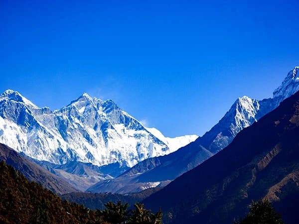
The Lower Dolpo Circuit Trek is one of Nepal’s most fascinating journeys, immersing you in the remote country of western Nepal. The trail passes through the heart of Dolpo, a region known for its dramatic mountain scenery, ancient Tibetan culture, and untouched wilderness. The trek offers a chance to experience a part of Nepal that has remained isolated for centuries, where traditional lifestyles are still preserved.
The route leads through Shey Phoksundo National Park, home to Nepal’s deepest and most beautiful lake, Phoksundo. Along the way, trekkers encounter barren cliffs, high passes, turquoise rivers, and hidden valleys that are dotted with traditional villages and Buddhist monasteries. The influence of Tibetan Buddhism is strong here, as reflected in the prayer flags, mani walls, and centuries-old gompas that line the trail.
Although considered a challenging trek due to its remoteness and altitude, the rewards are immense. You’ll cross several high passes over 5,000 metres, walk through untouched landscapes, and witness cultural traditions that few outsiders have seen. Unlike more commercial routes, Lower Dolpo offers true solitude, making it ideal for adventurous trekkers seeking a raw and authentic Himalayan experience.
This journey is more than just a trek,it is an immersion into the wild beauty of Dolpo and a window into the resilience and spirituality of the people who call this remote land home.
Before You Arrive
For a smooth and easy start, we highly recommend arriving in Kathmandu by 4 PM the day before we leave. This gives you enough time for a final gear check, a trip briefing with your guide, and to make sure you have everything you need before heading to the trek.
Online Briefing
This is like having our first coffee before the trip, but online! This online meeting is our chance to show you everything that will happen on the trip. We'll discuss what to bring and what each day will be like and answer any questions. After you book, we'll send you an email with a couple of times when we can talk. We'll set up the meeting after the booking process is completed. Also, our trek itinerary does not include your hotel stay in Kathmandu. During the online meeting, please share your preferences, budget, and the standard of the hotel you would like to stay at in Kathmandu. We will arrange it for you accordingly.
Your Trek, Your Way
Experience the Himalayas on your terms. We create personal, intimate treks for groups of two or more. Whether you select our Budget, Standard, or Luxury package, your adventure will be exclusively for you and your companions, for a comfortable and personal journey from start to finish.
Kathmandu Accommodation
Your hotel in Kathmandu is not included in the trek package. During the online briefing before your trek, we will ask about your preferences and budget, whether you want a simple guesthouse or a five-star hotel, and help you arrange it. Your trek package begins when you leave Kathmandu for the mountains.
Compare Our Three Packages
| Budget | Standard | Luxury | |
|---|---|---|---|
| Price from | USD 1,199 | USD 2,499 | USD 3,500 |
| Meals | Choose your own (approx. USD 15-25/day) | 3 meals + tea + fruits + 2L water daily | All meals + all drinks anytime (except alcohol) |
| Room | Shared teahouse | Private twin w/ bathroom | Private deluxe w/ bed heater |
| Porter | Not included | 1 per 2 trekkers | 1 per trekker (carry nothing) |
| Guide | 1 guide, assistant at 8+ | 1 guide per 6, assistant at 6+ | 1 guide per 2 trekkers |
| Transport | Local vehicle | Shared tourist vehicle | Luxury private vehicle |
| SIM data | SIM only | Limited data | Unlimited data |
| Best for | Backpackers and independent travellers | Comfort trekkers, couples, families | Premium experience seekers |
Himalayas for Every Budget, same expert guides, same safety, three comfort levels.
Your Trek, Our Family
Shreejan Simkhada doesn’t just run a trekking company, he comes from three generations of Himalayan expertise. His grandfather arranged expeditions in the 1960s. His father served at the Nepal Tourism Board. Shreejan personally designs every itinerary and hand-picks the guide for your group.
Your guide will be one of our Nepal government well-trained professionals, qualified mountaineering experts, all with years of Himalayan experience. Shreejan briefs every guide personally before your trek begins.
Need anything? WhatsApp Shreejan directly: +977 9810351300.
Our Credentials
- 197+ TripAdvisor Reviews, 4.9 out of 5 stars, TripAdvisor Travellers Choice 2024
- 90+ Google Reviews, 4.8 out of 5 stars
- TAAN Certified, Member #1586, Government Reg: 147653/072/073
- Secure 10% Deposit, pay just a 10% deposit to reserve, via Himalayan Bank
- Three Generations, three generations of family guides in the Himalayas
Solo Trekkers Welcome
Most of our trekkers join solo, you will be part of a small group of like-minded adventurers from around the world. Our groups are kept small (2-20 people) so you get a personal experience, not a conveyor belt. Many of our solo trekkers tell us the group becomes like a second family by day three.
You also have the option to book the trek privately for yourself. If you choose to make it a public group, we will list your dates as fixed departures on our website so other solo travellers can join you.
Difficulty: Easy (1/5)
The shortest trek we offer, perfect for those with just 3 days. You will walk 4-5 hours per day to a maximum of 3,771m with panoramic Himalayan views. Suitable for anyone with basic fitness.
Trek With a Purpose, Changing the World, One Step at a Time
A portion of every booking supports the Nagarjun Learning Center, founded by our family in 2019. Today, 70 children receive free education and hot meals daily at our flagship centre in Saldum Village, Dhading District. We have also provided free medical care to 600+ people and reached 275+ women through support programmes. The centre is verified and listed on the UN Partner Portal.
When you trek with us, you are not just climbing mountains, you are building futures. Trek With a Purpose.